
Plotting Archaeological Objects using GPS
GPS (Global Positioning System) is a satellite-based navigation system: a network of satellites that orbit the earth and transmit signals to GPS receivers on earth. By comparing the time a signal was transmitted by a satellite with the time it was received the receiver calculates the user's exact location: the time difference tells the GPS receiver how far away the satellite is, so with distance measurements from a few more satellites the receiver can determine the user's position.
How can GPS technology be used to plot archaeological finds?
With the simple click of a button, a handheld GPS receiver can plot the National Grid Reference (NGR) of a findspot within just a few seconds: the procedure may vary as all handheld GPS receivers are not designed the same way (see examples below).
How to record a findspot:
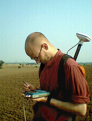
- Stand above the findspot.
- Record the NGR using the GPS receiver.
- Mark a plastic finds bag with the NGR.
- Place the find in the finds bag.
Note: before recording findspots of archaeological finds ensure the GPS receiver is set to the correct ‘time zone’ (UK) and ‘map datum’ (British National Grid). Most GPS receivers are made by US companies and set to record Longitude and Latitude.
How precise are handheld GPS receivers?
 Most handheld GPS receivers display a 10 figure NGR (1sq metre), but their precision (accuracy) will be less than this: perhaps between 10 and 15sq metres. Finders using a low cost receiver - such as the Garmin etrex or geko 201 - should be reasonably confident of the precision of 8-figure NGR. Certainly using a GPS receiver in the field allows finds to be recorded with greater precision than is usual for metal-detected finds. Receivers with WAAS (Wide Area Augmentation System) capability may improve findpost precision to less than three metres on average.
How much do handheld GPS receivers cost and where can I buy them?
A low cost receiver will cost between £80 and £100. Unless you are prepared to pay lots of money, more money will usually mean more features not greater precision.
GPS receivers are mostly used by walkers and so can be obtained from High Street stores, such as Dixons and Millets. However, the best prices can often be obtained by buying online, at sites such as www.globalpositioningsystems.co.uk, or sites that compare prices, like www.kelkoo.co.uk.
How to plot a findspot using the Garmin Etrex (about £85):
Once the receiver is switched on (power button) you will see the ‘satellite page’. When the receiver is ready to use (i.e. once it has tracked satellites) it will display the message ‘ready to navigate’. Next use the ‘page’ button to get to the ‘menu’ (4 clicks of the button). Then select ‘mark’ using the ‘enter’ button. The NGR of the findspot (e.g. TQ 12345 67890) will be shown below a man holding a flag. Use the ‘enter’ button when ‘ok’ is highlighted if you want to save this ‘waypoint’
How to plot a findpot using the Garmin Geko 20
Once the receiver is switched on (red button) you will see the ‘satellite page’. When the receiver is ready to use (i.e. once it has tracked satellites) it will display the message ‘ready to navigate’: it is best to wait until the ‘accuracy’ rating is 10 metres or lower before you try to plot a findspot. Next use the ‘page button’ (two rectangles overlapping each other) to get to the ‘menu page’ (4 clicks of the button). Then select ‘mark’ using the ‘ok’ button. The NGR of the findspot (e.g. TQ 12345 67890) will be shown below a man holding a flag. Press ‘ok’ if you want to save this.
About Us
About our Site

Find us
The British Museum, Great Russell Street, London WC1B 3DG.
T: +44(0) 20 73238618